This documentation is under construction. Help us improve it by sending your recommendations and suggestions to support@ara-uas.com.
Map Overview Page
- Guillaume Charland-Arcand
- Guillaume Dorion-Racine (Unlicensed)
- Elena Toutchinskaia (Deactivated)
This page presents the map page of SkyControl.
Page Summary
Overview
The GCSS Map Page displays two areas, the map area (marked in red) and the waypoints area (marked in green). The Sidebar (marked in blue) is common to all pages, and it is explained here.
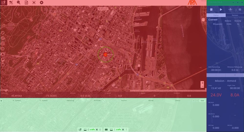
Map Area
The map area is the main feature of the map tab. It displays UAS position and heading and help you plan a mission, using waypoint tools. If UAS position is not available to SKYMATE™, it will display the UAS at a default location. The UAS is denoted with an orange icon.
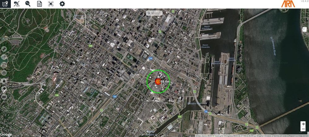
You can interact with the map area using your mouse to navigate around and to zoom in and out. You can switch between Map and Satellite views using the buttons of the top-left corner. There are also some icons that can be used to perform actions, as explained hereafter.
Map Manipulation Tools
The map area contains the following map manipulation tools.
| Map Manipulation Tools | |
|---|---|
Search bar | In/out Zoom |
|
|
Search for an address, an establishment, a geographic location, a prominent point of interest, or GPS coordinates. | Zoom in and out into the map. |


Mission Planning Tools
The map area contains the following mission planning tools.
| Mission Planning Tools | ||||||
|---|---|---|---|---|---|---|
| Measure | Waypoint | Grid Waypoints | Set Launch | Center | Eraser | Geofence |
|
|
|
|
|
|
|
This allows you measure the distance between 2 points on the map. Values are displayed in metres. | This allows to add waypoints on the map. | This will generate a grid of waypoints over an area defined by the user. | This sets Launch location on the map. This is where the UAS will return if a return to launch is triggered. | This centers the map to the UAS's current location. | This clears objets such as distances and geofence areas. | This defines circular and trapezoidal geofence areas. |


Waypoint Area
The waypoint area allows you to manage each waypoint by listing and setting its characteristics, such as its position, maximum velocity of travel, heading mode, and waypoint mode. How to define and set waypoints is explained here. This area also displays relevant data on the UAS status, that is :
- Current Position (Latitude, Longitude and Altitude)
- Current Horizontal Speed (m/s)
- Current Vertical Speed (m/s)
- Distance to the current waypoint (m)
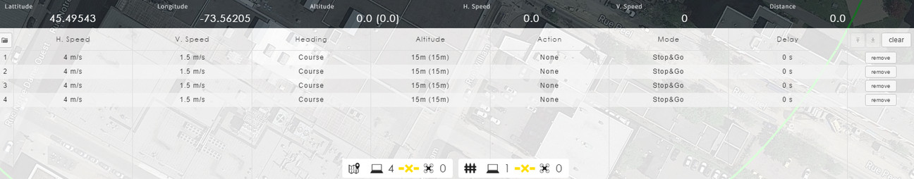
Two values are displayed in the altitude column : the first one is the altitude in the local frame and the second one (in brackets) is the GPS altitude.
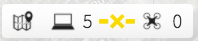
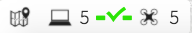
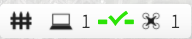
The area also includes two indicators to signal if waypoints and geofence lists are synchronized between the GCSS and SKYMATE™. An example of these indicators is given in the following table.
| Synchronization Indicators | |||
|---|---|---|---|
Waypoints | Geofence | ||
|
|
|
|
| 5 waypoints defined on the GCSS, 0 waypoints uploaded into SKYMATE™. Waypoints are not synchronized. | 5 waypoints defined on the GCSS, 5 waypoints uploaded into SKYMATE™. Waypoints are synchronized. | 1 geofence defined on the GCSS, 0 geofence uploaded into SKYMATE™. Geofence is not synchronized. | 1 geofence defined on the GCSS, 1 geofence uploaded into SKYMATE™. Geofence is synchronized. |

© ARA Robotique Inc - 2018